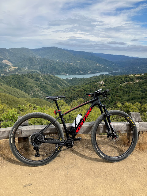
When we last left off, I had just purchased a shiny new 360 camera, the Insta360 X3.
I discussed this upgrade in a previous post, so I'll skip ahead to the experience of actually using it.
The first capture I did was this short stretch of closed off road, which is mostly used for fire/emergency access to the neighbourhood just up the hill.
I captured this using the Insta360 app on my iPhone to record GPS, because the X3 sadly does not have a built-in GPS.
I also captured this neighbouring fire road.
As well as an adjoining trail, which you can't see, because the recorded GPS track contained errors. This is about to become a theme.
I also recorded some other segments in Belgatos Park, such as this lovely little connector path.
So with things... sort of working, I set out on my bike to record some longer stretches of trails. Specifically, I captured this happy little trail that goes behind some apartment buildings, and connects to a gravel road that runs along a canal.
I also captured that gravel road, but the import of that segment seems to have gotten curiously stuck, so I guess we'll see what happens with that.
I was still having problems with GPS errors, but I decided to roll with it and see if I could just recover the files later. To that end, I set out a few days later to climb up Kennedy and capture Limekiln trail. One might wonder why I didn't also capture Kennedy trail, and the answer is that I don't have enough battery to capture that length of trail while slowly climbing it, and I only get one descent per climb. Capturing Kennedy will wait for another day.
Anyway, the result is this.
Which you might notice is incomplete and contains gaps. Because, again, GPS errors. The good news is that I know how to recover from these errors, and I'll be posting that in a follow-up later.
Anyway, I was getting rather sick of these GPS errors ruining my day, plus the requirement to keep my iPhone running screen-on for the whole capture was a bit of a drag, so I bit the bullet and forked over a few more bucks for the Insta360 GPS remote dongle.
Which you may or may not have noticed in the image at the top of this post. This resulted in far more reliable GPS captures, which I validated by riding up Dirt Bohlman. Which is more commonly known as Aquinas Trail.
This resulted in some very reliable captures, as you can see here.
The bench was a little less busy on the way up, so I was able to stop and enjoy a short snack before bombing back down with the camera rolling.
Anyway, so far it's been a bit of a mixed bag but I think I've got the process fairly dialled in at this point. I still have a few GPS-botched tracks to recover, but I can get to those when I get to those. In the meantime, I'll just let my legs recover a little from a long weekend full of way too much pedalling on my bike.


No comments:
Post a Comment